


cercoiux

cagna
User
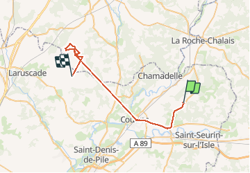

Length
37 km

Max alt
114 m

Uphill gradient
427 m
Km-Effort
42 km

Min alt
5 m

Downhill gradient
414 m
Boucle
No
Creation date :
2021-03-29 14:56:13.048
Updated on :
2021-03-30 14:52:42.774
21h28
Difficulty : Easy

FREE GPS app for hiking
 SityTrail
IGN / Geographical institutes
SityTrail Plus
The world is yours!
About
Trail Walking of 37 km to be discovered at New Aquitaine, Gironde, Le Fieu. This trail is proposed by cagna.
Description
bien
Positioning
Country:
France
Region :
New Aquitaine
Department/Province :
Gironde
Municipality :
Le Fieu
Location:
Unknown
Start:(Dec)
Start:(UTM)
733675 ; 4994407 (30T) N.
Comments